Makai, Tritan Software to launch advanced ocean vector chart services (OVCS)
Makai Ocean Engineering has announced a collaboration with Triton Software Ltd to integrate the Ocean Vector Chart Service (OVCS) and provide seamless access to high resolution nautical charts directly in MakaiPlan, its submarine cable route planning software.
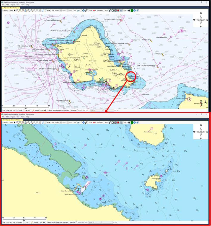
This partnership introduces a powerful new feature to MakaiPlan by incorporating Triton Software’s API and hosted server for Lloyd’s Register’s worldwide vector dataset. The OVCS feature empowers users to access and display the web hosted electronic navigational charts with enhanced resolution, detail, and precision compared to traditional Admiralty raster charts. Moreover, users can interrogate individual objects within the charts to view their attributes, enabling greater accuracy and efficiency during the planning process.
The enhanced charting capabilities of OVCS make it easier for planners to:
- Reduce risks associated with cable routing and installation.
- Improve efficiency by centralizing essential data within MakaiPlan.
- Make more confident and informed decisions with real-time access to detailed marine information.
“OVCS provides worldwide coverage in various scales, divided into several levels,” said Jonathan Shapiro, Chairman of Triton Software Ltd. “This means our customers can tailor their coverage to meet specific operational needs.”
The installation of submarine cables is a technically demanding process, requiring precise planning to ensure cables are installed in the safest and most cost-effective way. While Makai’s software already handles detailed route optimization, obstacle avoidance, and raster nautical charts, OVCS adds value by improving how efficiently planners can automatically load and interact with the data.