Shell, Chevron shut-in oil facilities offshore U.S. Gulf of Mexico as “major” hurricane anticipated
(Bloomberg) – The U.S. Gulf Coast from Mississippi to the Florida Panhandle is at risk of a hurricane strike by the end of the week, as a patch of turbulent weather in the Atlantic becomes more organized.
The system, with winds of 30 miles (48 km) per hour, was about 110 miles south-southwest of Grand Cayman and has already prompted tropical storm warnings and hurricane watches for parts of Cuba and Mexico, the U.S. National Hurricane Center said in a 2 p.m. New York time advisory. If winds reach at least 39 mph and it becomes more organized, it will be named Tropical Storm Helene.
Forecast models predict the system will thread the gap between Cuba and Mexico’s Yucatan Peninsula, driving north across the warm waters of the Gulf before making landfall somewhere between Bay St. Louis, Mississippi — east of New Orleans — and Florida’s western coast. It would be the fourth named storm to hit the US mainland this year.
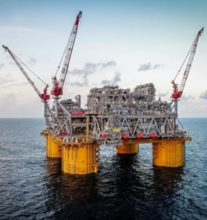
While the storm is expected to strike the northeastern part of the Gulf, it has had an impact on some energy operations. Shell Plc shut the Appomattox and Stones oil facilities and evacuated non-essential personnel from assets in the Mars corridor, according to a company statement. Chevron Corp. also removed some crews from offshore installations.
“As it moves, it will encounter ideal conditions,” Tyler Roys, a senior meteorologist at commercial forecaster AccuWeather Inc., said in an interview. “We are very concerned for rapid intensification Wednesday to Thursday afternoon.”
The storm threatens to be the first major hurricane, with winds of 111 mph or more, to hit the U.S. this year. That would make it at least a Category 3 on the five-step Saffir-Simpson scale.
The storm’s track will be determined by a larger low-pressure system across the central U.S. that could steer it ashore anywhere from southern Mississippi to western Florida, Roys said.
Meanwhile, a second system in the Pacific will smash Mexico’s Guerrero and Oaxaca states as a major hurricane with winds topping 120 mph when it comes ashore Tuesday, the hurricane center said. Wind speeds have more than doubled since midnight, now peaking at 85 mph, and will continue to strengthen.
This means it has met the criteria of rapid intensification, a dangerous situation that occurs when a storm’s winds increase by 35 mph or more in just 24 hours. A hurricane warning is in place along the coast from Punta Maldonado to Bahías de Huatulco.
There is a chance more than 30 inches (76 cm) of rain will fall across the mountainous region, leading to deadly floods and landslides, Roys said.
“We are very nervous,” he said.


